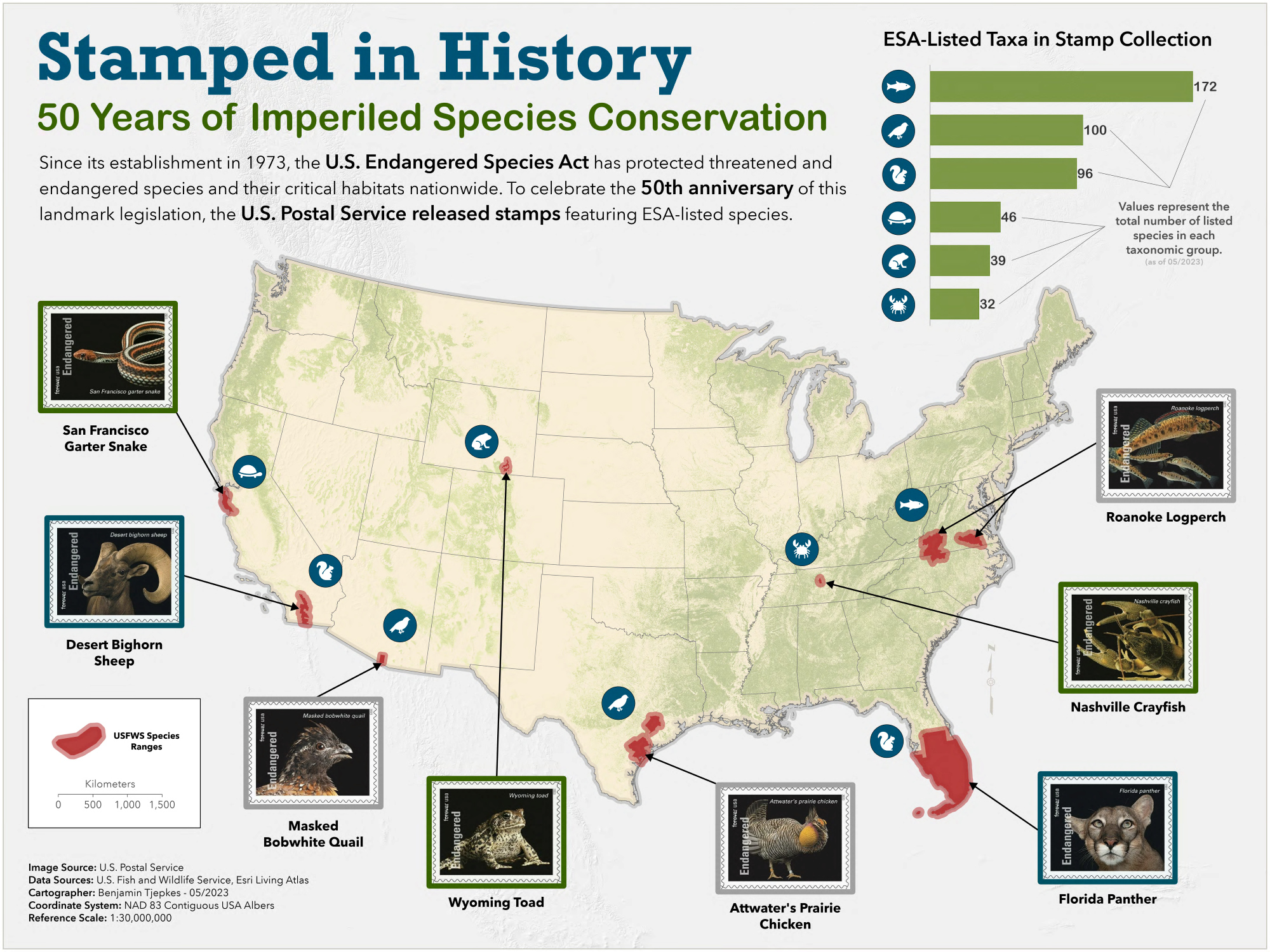
This map was produced as a creative project in celebration of the 50th anniversery of the U.S. Endangered Species Act. The final map product was submitted to the 2023 GIS Certification Institute Map Contest, where is won 2nd place in the professional category. Map creation was performed in ArcGIS Pro 3.1 using data sourced from the U.S. Fish and Wildlife Service, U.S. Postal Service, and the Esri Living Atlas.