Task & Objective
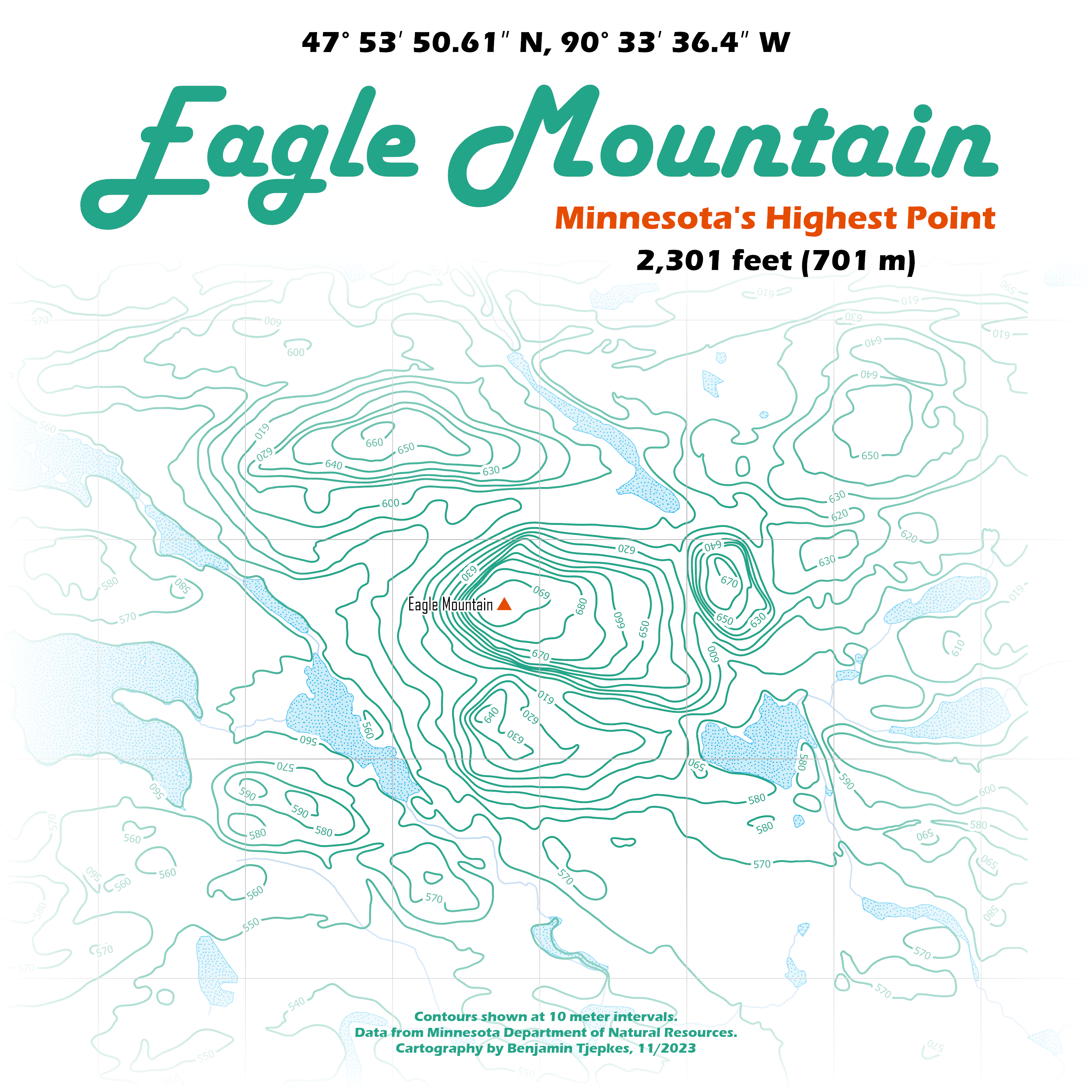
The prompt for this map was for Day Two of the 2023 30 Day Map Challenge, which designated “lines” for the main subject. I had been wanting to work more with contours, so this was the perfect opportunity. The final map shows the location of Eagle Mountain surrounded by nearby lakes and the elevation contour lines.
You can see all my contributions to the 2023 #30DayMapChallenge.
Tools & Workflow
Data were downloaded from the Minnesota Department of Natural Resources GIS hub site, including a 3-meter digital elevation model (DEM) and a general hydrological features layer.
In ArcGIS Pro, the DEM was used to generate a simplified 10-m contour feature class. The lakes and stream features were then added to provide context for the surrounding area.